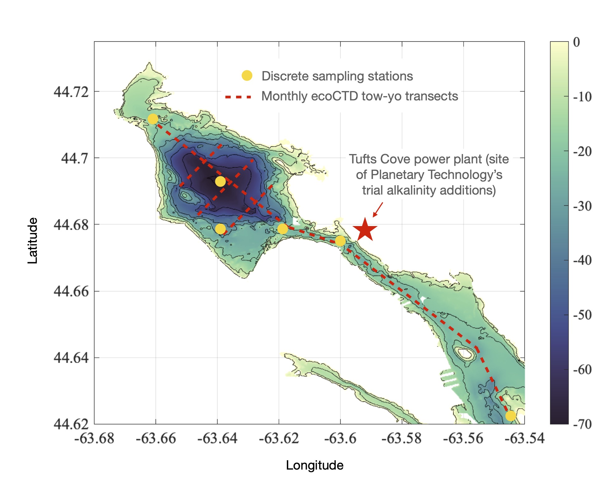
Fig.1 - Bedford Basin and Halifax Harbour survey locations
Complementing the DFO supported Bedford Basin Monitoring Program,
the Bedford Basin Surveys have been conducted by Dalhousie ocean scientists since late 2021 to improve our understanding of the spatial distribution of water mass properties in Bedford Basin and Halifax Harbour.
Each month, we go out and make the following measurements:
Underway ecoCTD transects
Discrete water sampling stations for
carbon system parameters
nutrients
eDNA
Sediment samples
The surveys have also been used as a platform for testing AUVs, drifters and making drone images of surface temperature in the region.
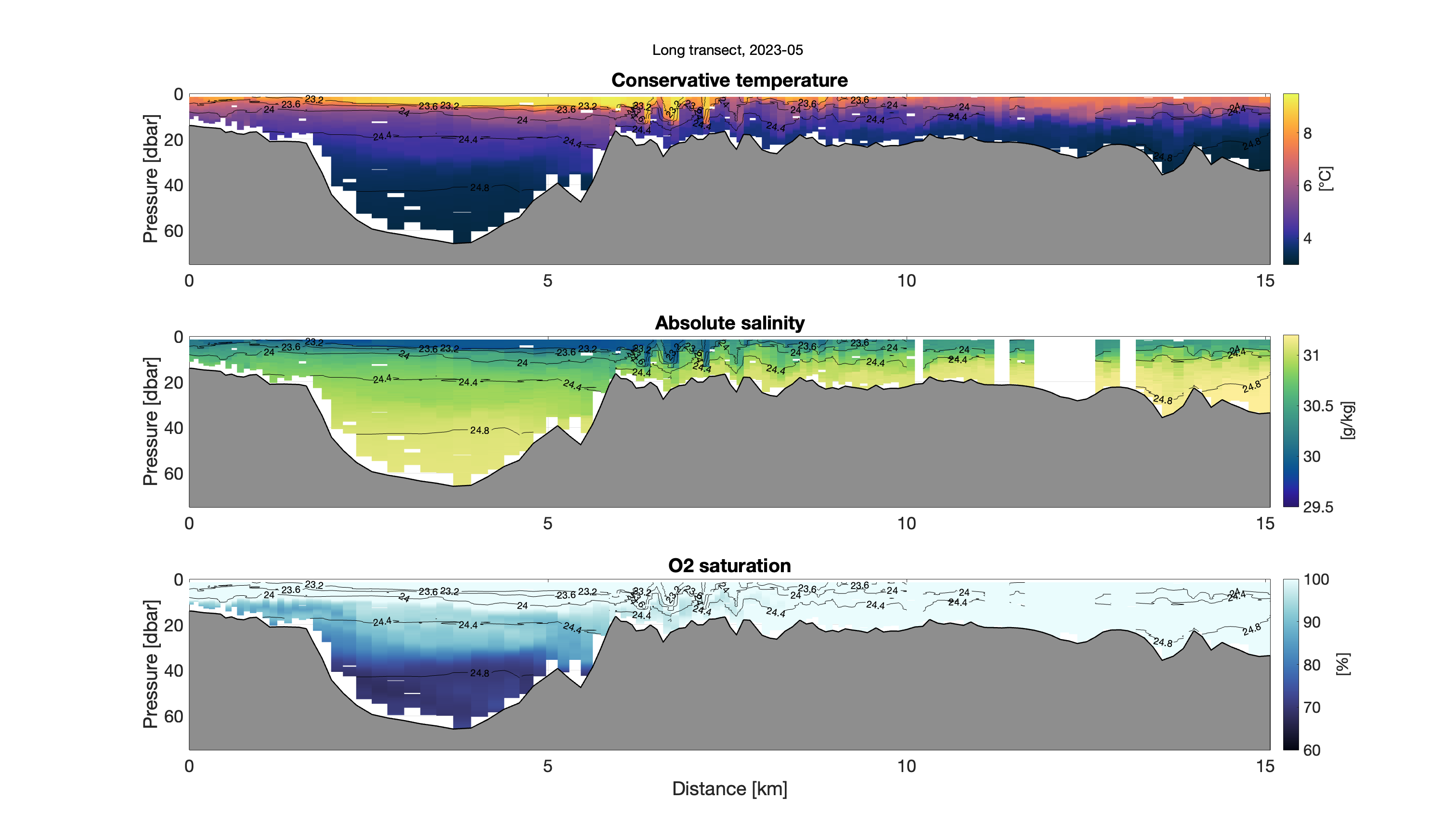
An example of the sorts of data that we obtain from the ecoCTD are shown the figure below, where we have used the measured data to
map temperature, salinity and oxygen saturation along a transect from the Sackville River out to McNabs Island.
Fig.2 - Transect from Sackville River out to McNabs Island from May 2023 (by Ruby Yee).
Our work is motivated by a desire to better understand the circulation and biogeochemical variability in the region.
Ultimately, we seek to improve our ability to accurately model and predict the impacts of ocean alkalinity enhancement at this site. In addition to the monthly surveys, we have also deployed occasional moorings through the Narrows in 2023 to measure stratification and currents.
We are working closely with Ocean AlkAlign, and our industrial partners
Planetary Technologies to coordinate our observations and maximize scientific return.